

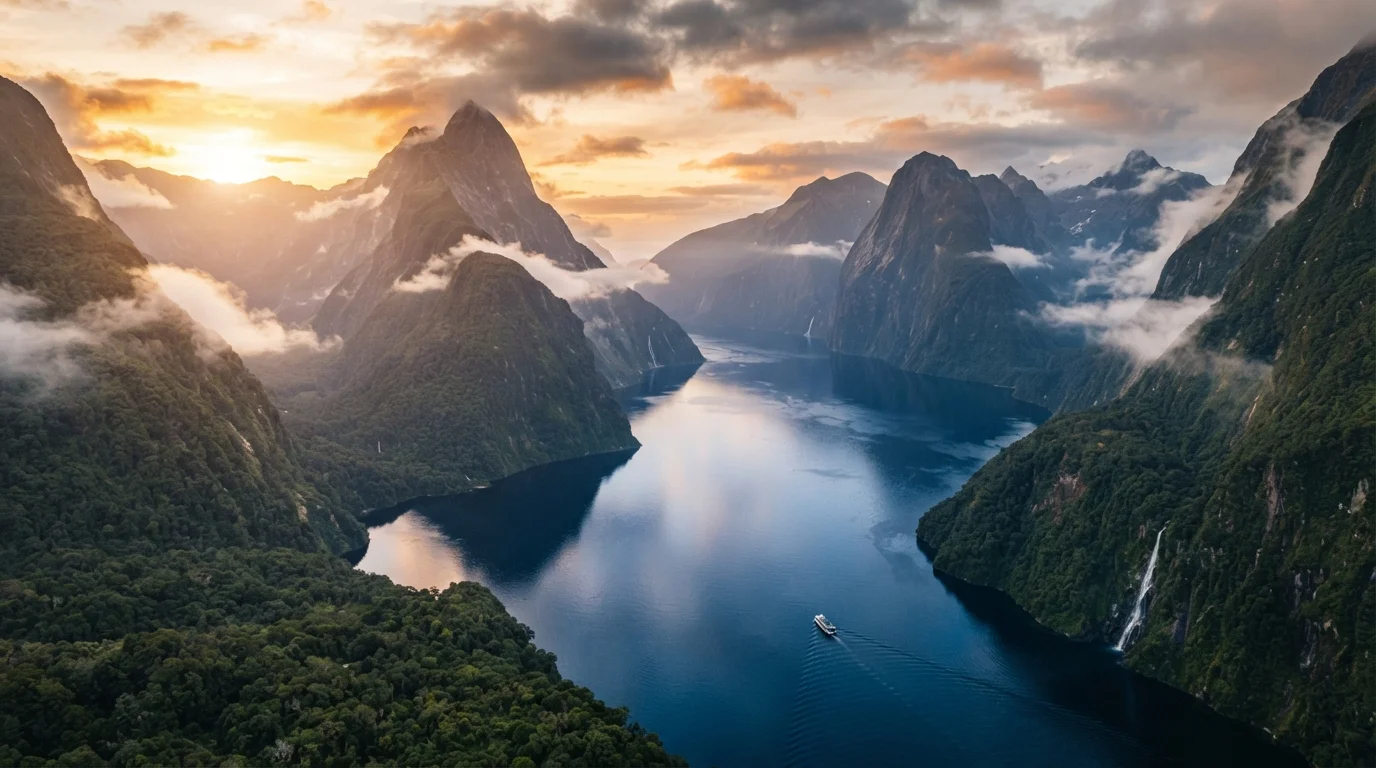
Understanding the Two-Island Geography
New Zealand sits in the southwestern Pacific Ocean, approximately 2,000 kilometres (1,240 miles) southeast of Australia. The country comprises two main landmasses — Te Ika-a-Māui (the North Island) and Te Waipounamu (the South Island) — separated by the Cook Strait, a roughly 22-kilometre-wide stretch of open water at its narrowest point.
Together the islands span about 1,600 kilometres from north to south, producing a range of climates and ecosystems that few countries of comparable size can match. The North Island is warmer, more populous, and home to most of the country's major cities. The South Island is larger by land area, significantly more mountainous, and considerably less densely settled. Understanding this basic division is the starting point for any itinerary.
For travellers curious about how island destinations compare globally, the volcanic and geothermal character of New Zealand's North Island draws occasional comparisons to destinations like Portugal's Azores, though the scale and cultural context differ substantially.
The North Island: Geothermal Activity, Cities, and Culture
Auckland, New Zealand's largest city, serves as the main international gateway for most long-haul travellers. It sits on a narrow isthmus between two harbours and is built across a volcanic field of more than 50 cones, several of which are accessible as public parks. From Auckland, travellers commonly head south toward the Waikato and Bay of Plenty regions.
Rotorua, roughly three hours south of Auckland, is one of the North Island's most-visited inland destinations. The area sits on an active geothermal zone — boiling mud pools, erupting geysers, and sulphur-tinged steam are a constant feature of the landscape. Rotorua is also a significant centre for Māori culture, with several iwi (tribal groups) offering guided cultural experiences, including traditional hāngi meals and kapa haka (performing arts) performances.
Further south, Tongariro National Park contains three active volcanoes and is a dual UNESCO World Heritage Site — recognised for both its natural landscape and its spiritual significance to the Māori people. The Tongariro Alpine Crossing, a 19.4-kilometre day hike, is consistently cited as one of the most traversed single-day walks in the country, though conditions change rapidly and hikers should consult current weather and track status before setting out.
Wellington, the capital, occupies the southern tip of the North Island. Compact and walkable, it is home to the national parliament, Te Papa Tongarewa (the national museum), and a well-regarded food and arts scene. Wellington is also the main ferry departure point for the South Island.
When planning time in Rotorua, contact the local iwi visitor centres directly rather than relying solely on general booking platforms — they can explain the cultural protocols expected at specific sites, which makes the experience more meaningful and respectful.
Māori cultural sites carry specific tikanga (customary practices) that differ by location; understanding these in advance prevents inadvertent disrespect and deepens the visitor experience.
Book Great Walks hut passes through the Department of Conservation well in advance — some routes, like the Milford Track, operate a quota system and sell out months ahead for the peak summer window.
New Zealand's Great Walks are managed under a fixed-capacity booking system to protect the environment; last-minute planning routinely leads to disappointment, especially between December and February.
The South Island: Alpine Terrain, Fjords, and Wide-Open Space
The South Island's defining geographic feature is the Southern Alps — a spine of mountains running nearly the full length of the island, with Aoraki/Mount Cook reaching 3,724 metres, the country's highest peak. The alps create a sharp climate divide: the west coast receives some of the highest annual rainfall in the country, while the eastern Canterbury Plains remain comparatively dry.
Queenstown, on the shores of Lake Wakatipu, functions as the South Island's adventure tourism hub. Visitors arrive for bungee jumping, jet boating, skiing (in winter), and access to the Remarkables mountain range. Wanaka, roughly an hour north, offers a quieter alternative with access to Mount Aspiring National Park.
Fiordland National Park, in the island's far southwest, contains Milford Sound (Piopiotahi) and Doubtful Sound — two glacially carved fiords that draw visitors from around the world. Access to Milford Sound requires navigating a single mountain road that can close during heavy snowfall or rockfall events; travellers should monitor New Zealand Transport Agency advisories before making the drive. The logistical challenges of reaching remote southern landscapes share some parallels with other extreme destinations, though New Zealand's infrastructure is considerably more developed.
The Abel Tasman National Park at the island's northern tip offers a contrasting experience — golden sand beaches, calm coastal waters, and a well-maintained coastal track accessible by water taxi or on foot.
3,724 m
Height of Aoraki/Mount Cook
New Zealand's highest peak anchors the Southern Alps along the South Island's spine.
~1,600 km
North-to-south span of New Zealand
The distance from Cape Reinga in the north to Bluff in the south produces a wide range of climates.
13
UNESCO-listed Great Walks in New Zealand
The Department of Conservation manages a network of multi-day walking tracks, each bookable through an official quota system.
When to Go: Seasons and Climate Across Both Islands
New Zealand's seasons are the reverse of the Northern Hemisphere. Summer runs from December through February, autumn from March to May, winter from June to August, and spring from September to November.
Peak tourist season falls in the Southern Hemisphere summer, when school holidays align with warm temperatures and longer daylight hours. This period brings the highest accommodation demand and prices, particularly in Queenstown and coastal areas. Shoulder seasons — March through May and September through November — are often preferred by experienced visitors for their reduced crowds, stable weather, and better availability on popular tracks.
Winter is ski season in the South Island, with the Remarkables, Coronet Peak, and Mount Hutt among the main commercial ski areas. The North Island's higher-altitude areas also receive winter snowfall. Travellers focused on hiking should note that alpine tracks, including the Tongariro Alpine Crossing, carry genuine weather risk year-round and can be temporarily closed.
The North Island generally maintains warmer temperatures throughout the year, with the Northland region at the top of the island experiencing a subtropical climate. The South Island's west coast is notably wetter, while Otago and Marlborough in the east are drier and sunnier on average.
Getting Around: Transport Options Between and Within Islands
Inter-island travel centres on two options: the Interislander or Bluebridge ferries, which cross the Cook Strait between Wellington and Picton (approximately 3–3.5 hours), or domestic flights connecting major airports. The ferry crossing is scenic and allows travellers to bring a vehicle across — a practical option for those driving both islands. Rough sea conditions can occasionally delay or redirect ferries; travellers should factor buffer time into itineraries crossing the strait.
Domestic flights connect Auckland, Wellington, Christchurch, Queenstown, Dunedin, and several regional centres. For those short on time, flying between islands is efficient, though it forfeits the scenic strait crossing.
Self-driving is the most flexible way to reach New Zealand's national parks, rural coastlines, and smaller towns. Roads are generally well-maintained, though mountain passes and the Milford Road require attentive driving. New Zealand drives on the left side of the road. International visitors should confirm whether their licence is valid for driving in New Zealand and for how long — official immigration and transport guidance should be the reference point.
Intercity coaches and shuttle services connect most major destinations and are commonly used by budget travellers. Organised tour structures are another practical option; for context on how group travel compares to independent travel, see our look at solo travel versus group tours.
Mountain Road Closures Can Affect Key Routes
The Milford Road, the only road access to Milford Sound, is subject to closure without notice due to rockfall, avalanche risk, or heavy snowfall. Before driving this route, check the New Zealand Transport Agency website and the Department of Conservation for current advisories. Building flexibility into the itinerary around this leg of a trip is strongly recommended.
Practical Entry, Visa, and Planning Considerations
New Zealand introduced the Electronic Travel Authority (ETA) for visa-waiver countries, including the United States, United Kingdom, Canada, and most EU nations. The ETA is applied for online before travel and carries a fee. Visitors from countries that do not have a visa-waiver arrangement must apply for a visitor visa in advance. Requirements and eligibility change; travellers must verify their specific status through Immigration New Zealand's official website before booking.
New Zealand has strict biosecurity rules. Declaring all food, plant material, and outdoor equipment at the border is required — penalties for non-declaration are significant. Hiking boots and camping gear are commonly inspected and may be cleaned by border staff if found to carry soil or organic material.
The New Zealand Dollar (NZD) is the national currency. Card payments are widely accepted, though some rural and conservation areas have limited connectivity. Travel insurance is not mandatory but is broadly advisable, particularly for adventure activities or remote hiking. Travellers interested in longer stays or remote working arrangements may find the overview of digital nomad visa structures a useful reference, though New Zealand's specific visa categories should be confirmed through official sources.
Emergency services are reached by dialling 111. The national park and conservation network is managed by the Department of Conservation (DOC), which publishes current track conditions, hut bookings, and safety alerts at its official site — an essential resource for anyone planning multi-day walks.
This article is for general informational purposes only. Entry requirements, visa conditions, transport schedules, and safety conditions change. Always verify current requirements with official government sources and relevant operators before travelling.
The content on this site is for informational purposes only and is not a substitute for professional advice. Always consult a qualified professional for guidance specific to your situation.