

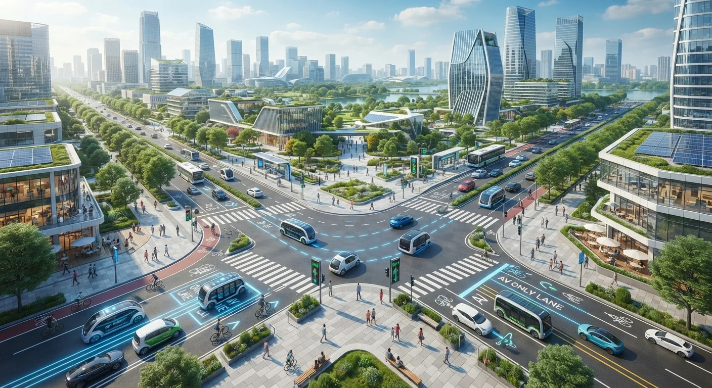
Streets Built for Vehicles That Don't Fully Exist Yet
Urban infrastructure has always lagged behind transportation technology. Highways were retrofitted for cars decades after the automobile arrived; cities are determined not to repeat that mistake with autonomous vehicles (AVs), ride-hail fleets, e-scooters, and connected transport networks. The result is a quiet but significant wave of street redesign already reshaping how American cities look and function.
This shift goes well beyond white paint on asphalt. Planners are rethinking curb allocation, signal timing, data-sharing agreements, and zoning rules simultaneously — often with limited budgets and uncertain timelines for when new vehicle types will actually scale. Understanding what's changing, and why, helps make sense of the construction and pilot programs appearing in downtowns from Phoenix to Pittsburgh. For a grounding in the vocabulary behind these changes, the mobility glossary covers terms like geofencing and platooning in plain language.
Curb Space Is Being Actively Managed and Repriced
For most of the 20th century, curb space was treated as a free, first-come resource — for parking, deliveries, and drop-offs alike. That model is breaking down under the pressure of ride-hail pickups, last-mile delivery vans, and the coming wave of AV drop-off demand. Cities including San Francisco, Seattle, and Washington D.C. have begun piloting dynamic curb management programs that designate specific blocks for specific uses at specific times of day, enforced through signage, sensors, and in some cases pricing. The goal is to reduce the double-parking and sidewalk blockages that currently plague dense commercial corridors and to reserve premium curb access for high-turnover, high-efficiency uses.
Dynamic curb management assigns specific blocks to specific uses, reducing double-parking conflicts in dense corridors.
Dedicated AV and Connected-Vehicle Lanes Are Being Piloted
Several U.S. cities and state transportation departments are studying or testing lanes reserved for autonomous or connected vehicles. The rationale is straightforward: AVs that communicate with infrastructure and with each other can travel at tighter following distances and smoother speeds — but only if they aren't constantly interrupted by unpredictable human drivers. Dedicated corridors allow these efficiency gains to be realized without requiring full AV adoption across the fleet. Michigan and Ohio have been among the more active states in designating test corridors along freight routes, while urban pilots in places like Las Vegas have tested AV shuttle lanes on lower-speed downtown streets.
Dedicated AV corridors let connected vehicles achieve efficiency gains without requiring full fleet-wide adoption first.
Smart Signals Are Learning to Serve Mixed Fleets
Traditional traffic signals operate on fixed timing plans adjusted seasonally at best. Adaptive signal control technology (ASCT) uses real-time sensor data — from cameras, radar, or connected vehicles — to extend or shorten phases based on actual traffic flow. As connected vehicles become more common, signals can receive direct data from approaching vehicles and adjust accordingly, a capability sometimes called signal priority when applied to buses or emergency vehicles. Cities including Pittsburgh and Columbus have deployed adaptive signal networks across significant portions of their arterial grids, with documented reductions in travel times and idling. The next evolution involves signals that actively negotiate with AV fleets rather than simply reacting to them.
Adaptive signals that negotiate directly with AV fleets represent the next frontier beyond current real-time traffic response.
Protected Micromobility Infrastructure Is Becoming Standard
The explosion of e-scooters and e-bikes as genuine transportation tools — rather than novelties — has forced cities to treat micromobility as a first-class mode rather than an afterthought. Protected bike and scooter lanes physically separated from vehicle traffic, dedicated corral parking zones at transit stations, and low-speed shared-use paths are now routinely included in street reconstruction projects in cities across the country. This infrastructure directly addresses the last-mile problem — the gap between transit stops and final destinations that has historically pushed people back into cars. Cities that invest in protected micromobility lanes report higher ridership on adjacent transit lines, suggesting the modes are complementary rather than competitive.
Protected micromobility lanes consistently boost adjacent transit ridership, proving the modes work together rather than compete.
Streets Are Gaining a Digital Layer: Sensors, Data Agreements, and Geofencing
Perhaps the least visible but most consequential change is the embedding of data infrastructure into physical streets. Cities are deploying roadside sensors, cameras, and V2I communication units that feed real-time data to traffic management centers — and, under negotiated agreements, to private mobility operators. Geofencing — the use of digital boundaries to trigger automatic vehicle behavior changes — allows cities to enforce speed limits, restrict AV operations to permitted zones, or require e-scooters to slow near schools without relying solely on human compliance. Los Angeles and Kansas City have been notable early adopters of city-operated mobility data platforms that aggregate feeds from multiple operators, giving planners a unified view of how streets are actually being used across all modes simultaneously.
Geofencing lets cities enforce speed limits and zone restrictions automatically, shifting compliance from human judgment to software.
What This Means for How We Move
Taken together, these infrastructure shifts signal a fundamental renegotiation of who — and what — the street is for. The private car no longer holds an uncontested claim on curb space, lane width, or signal priority. Ride-hail vehicles, autonomous shuttles, delivery robots, and micromobility devices are being written into street design from the outset rather than accommodated as afterthoughts.
Flexibility Matters More Than Permanence
Urban planners increasingly favor reversible street changes — moveable barriers, painted lanes, temporary signal configurations — over permanent construction when testing new mobility designs. This approach allows cities to evaluate real-world outcomes before committing capital budgets, and to adjust quickly if technology timelines shift or a pilot underperforms. Readers following infrastructure news should note whether a city's mobility project is described as a 'pilot' or 'permanent installation,' as this signals very different levels of commitment and funding.
This interplay between physical and digital infrastructure is explored in depth in the context of connected vehicle technology, where V2X communication links cars directly to the signals and lane markings described above. And as Mobility as a Service platforms mature, the physical street redesigns here become the hardware layer beneath a much larger software-driven transportation system.
None of this is guaranteed to unfold smoothly. Funding gaps, political resistance, and technology timelines that keep shifting make urban mobility planning a discipline defined as much by flexibility as by forward vision. But the groundwork is being laid — one curb cut, dedicated lane, and adaptive signal at a time.
The content on this site is for informational purposes only and is not a substitute for professional advice. Always consult a qualified professional for guidance specific to your situation.