

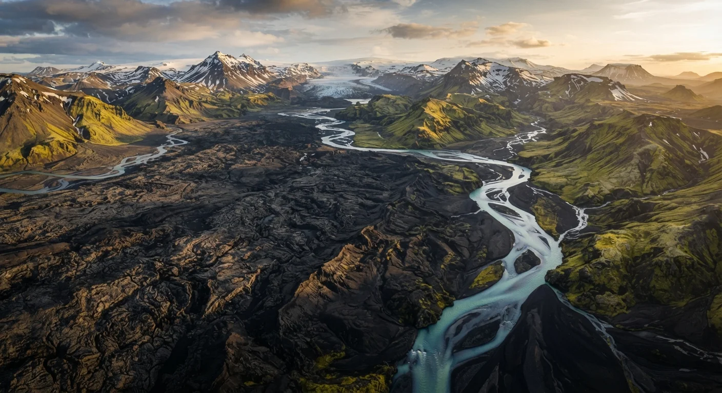
A Country Built on a Geological Boundary
Iceland occupies one of the most geologically unusual positions of any country on Earth. The island sits astride the Mid-Atlantic Ridge, the divergent tectonic boundary where the North American and Eurasian plates move apart at roughly 2.5 centimeters per year. Over millions of years, volcanic material has built up along this seam, pushing the seafloor upward until it breached the surface — forming Iceland.
At Þingvellir (pronounced roughly "Thing-vet-leer") National Park, this boundary is visible above ground as a rift valley. The park is a UNESCO World Heritage Site partly for this reason, offering one of the few places globally where visitors can walk along the edge of a tectonic plate boundary on dry land.
“Iceland is essentially a natural laboratory for plate tectonics. Nowhere else can you observe the Mid-Atlantic Ridge above sea level and study how diverging plates build new crust in real time.”
— Ármann Höskuldsson, Volcanologist at the University of Iceland's Nordic Volcanological Center
What Makes Iceland's Volcanoes So Active
Iceland's volcanic intensity comes from two sources working in tandem: the Mid-Atlantic Ridge and a geological hotspot beneath the island. A hotspot is a region where an unusually hot column of material from deep in Earth's mantle rises toward the surface, independent of plate boundaries. The combination creates an outsized concentration of volcanic systems.
The island hosts around 130 volcanic mountains. Eruptions in the Reykjanes Peninsula — most recently in a series beginning in 2021 — have drawn international attention and reshaped areas near the southwestern coast. Visitors to Iceland should always check current volcanic alerts issued by the Icelandic Meteorological Office, as eruption zones can change conditions on relatively short notice.
130
Volcanic mountains in Iceland
According to the Icelandic Meteorological Office, Iceland hosts approximately 130 volcanic mountains, with eruptions occurring on average every four to five years.
11%
Iceland's land area covered by glaciers
Glaciers, including Vatnajökull — Europe's largest by volume — cover roughly 11 percent of Iceland's total land surface, according to the National Land Survey of Iceland.
2.5 cm/year
Rate of tectonic plate separation
The North American and Eurasian plates beneath Iceland diverge at approximately 2.5 centimeters per year, according to U.S. Geological Survey data on mid-ocean ridge spreading rates.
Glaciers, Geothermal Energy, and the Landscape Visitors See
Despite sitting atop intense geothermal heat, glaciers cover approximately 11 percent of Iceland's land area. Ice caps like Vatnajökull — Europe's largest glacier by volume — persist because Iceland's latitude keeps surface temperatures low enough to sustain them year-round. Beneath Vatnajökull, however, several active volcanoes continue to operate. When these erupt under ice, they can generate glacial floods known as jökulhlaup, which have historically deposited vast plains of sediment across southern Iceland.
Geothermal activity also shapes daily life and infrastructure. Iceland generates the majority of its electricity from hydropower and geothermal sources, and geothermal heating warms most buildings in Reykjavík. The same underground heat that powers homes also feeds the natural hot springs that have become iconic visitor attractions across the country.
Iceland's geological kinship with other mid-Atlantic volcanic island chains is notable. Portugal's Azores archipelago, also situated on the Mid-Atlantic Ridge, shares a broadly similar geological origin. The Azores' volcanic lakes and thermal pools reflect the same tectonic forces at smaller scale, though each island group has developed its own distinct landscape character.
Check Official Sources Before You Travel
Iceland's volcanic environment can change rapidly. Before visiting geothermal areas, lava fields, or highland roads, consult the Icelandic Meteorological Office (en.vedur.is) and Safetravel Iceland (safetravel.is) for current hazard and road condition information. These are the authoritative sources for safety advisories on the island.
What This Means for Travel Planning
Understanding Iceland's geology helps travelers set realistic expectations. The landscape is genuinely dynamic — lava fields in the Reykjanes Peninsula that appear on current maps may not have existed a decade ago. Trails, roads, and access points can be altered or closed during periods of volcanic or seismic activity.
Travelers are encouraged to consult the Icelandic Meteorological Office's hazard maps and the Safetravel Iceland portal before departure and during their visit. Entry conditions, road accessibility, and regional safety advisories should always be verified through official sources, as conditions can change quickly in a geologically active environment.
Beyond safety considerations, the geology is the destination. Iceland's waterfalls cut through lava rock, its black sand beaches are composed of volcanic material, and its highland interior — the uninhabited region called the Highlands — is a raw volcanic desert unlike almost anywhere else travelers can visit.
Frequently Asked Questions
Iceland sits on the Mid-Atlantic Ridge and above a mantle hotspot, creating exceptionally high volcanic activity. The island has around 130 volcanic mountains, with eruptions occurring roughly every four to five years on average. This makes Iceland one of the most volcanically active countries in the world.
Technically, Iceland straddles both. The North American tectonic plate lies to the west of the country, while the Eurasian plate lies to the east. At Þingvellir National Park, visitors can stand in the rift valley between the two plates.
Most tourists visit Iceland without any volcanic incident. However, eruptions do occur periodically and can affect air travel and access to certain areas. Travelers are strongly advised to check alerts from the Icelandic Meteorological Office and follow local authorities' guidance before and during visits.
Groundwater seeps deep into the earth and is heated by magma close to the surface, then forced back up through cracks in the rock as geysers or hot springs. This geothermal energy also supplies the majority of Iceland's heating and electricity.
Iceland's high latitude keeps temperatures cold enough for glacial ice to persist, even as volcanic heat rises from below. When a volcanic eruption occurs beneath a glacier, it can trigger jökulhlaup — catastrophic glacial floods — which have historically reshaped large areas of Iceland's terrain.
The content on this site is for informational purposes only and is not a substitute for professional advice. Always consult a qualified professional for guidance specific to your situation.